Preston family
Introduction
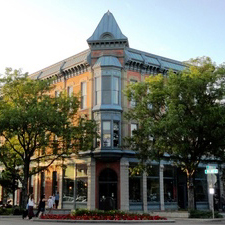
Old Town
Central Business District
North College Avenue District
Laporte Avenue and Old Fort Industrial Districts
Buckingham, Andersonville, AltaVista Neighborhoods
West Side Neighborhood
Holy Family Neighborhood
East Side Neighborhood
Southeast Growth Area
Other Factors in Determining Growth
Demographic Factors
Summary: Neighborhoods, Architecture, and Growth in the 1940s
Bibliography
Writing in 1983, Christian Schoeman remarked that "less destruction took place" in Fort Collins in the decades from 1920 until the Second World War. Certainly wartime priorities kept construction at a minimum, while the immediate postwar years witnessed a housing shortage until the G.I. Bill, reallocation of resources, and builders caught up to the demand. It is also well to keep in mind that even in 1950 the town numbered fewer than 15,000 people within the city limits, which were small in geographical area. The Poudre River defined the northern boundary of the city, the Colorado A&M campus and East Prospect represented the limits on the south, and to the east and west the city limits were about ten or eleven blocks from College Avenue. City Park and Grandview Cemetery formed an extreme extension westward.
Examination of the various neighborhoods sharpens and confirms a picture of a community small in size with many traditional features still in place. The neighborhoods will be discussed in sequence, starting with those that were commercial or industrial in nature, and then moving on to the residential neighborhoods that surrounded the commercial core. The emphasis will be upon both the existing built environment and new construction or development where it occurred. In addition, architectural trends and styles will be identified.
A final note: city directories are not available from 1941 through 1947, so discussion of postwar developments focuses upon 1948 rather than years earlier in the decade.
SOURCES:
City of Fort Collins Advance Planning. City of Fort Collins Annexation Trends.
As early as the 1920s there was a perception that retail firms were relocating from Old Town to College Avenue to take advantage of automobile traffic along that street, which served also as US Highway 287.The decline of Old Town as a commercial area continued after World War II. A comparison of maps created for a cultural resources inventory of the Old Fort Site reinforces this impression. The maps show the south side of Jefferson Street and immediate adjoining streets in Old Town lined with commercial structures little changed between 1925 and 1948. The 1948 City Directory lists a number of small businesses still in the area: restaurants, taverns, barbershops, hardware dealers, implement dealers, and blacksmith shops are among them. Also noticeable are several apartment complexes and older hotels. One of the latter, the Hotel Pine (242 Pine), offered furnished rooms; possibly others did so as well. Perhaps indicative of the demographics of Old Town was the fact that the Department of Public Welfare was located at 305 Jefferson Street.
SOURCES:
Historic Old Town Planning Committee. Old Town.
Marmor. Cultural Resources Inventory.
Marmor. An Inventory of Historic Properties.
Polk’s Fort Collins City Directory, 1948.
Schoeman. Survey of Historic Structures.
By the late 1930s the central business district (CBD) comprised College Avenue from Maple Street to Olive Street and portions of adjoining streets: Mountain Avenue, Oakland, Olive and Remington. The CBD remained essentially the same in the 1940s, with minor changes on the north and south. On College between Laporte and Maple a passerby would find a light industrial area featuring a mix of auto sales and service, lumberyards, agricultural equipment dealers, and similar firms. To the south, between Olive and Magnolia the First Methodist Church shared the block on College with the Bauman Apartments, the Mountain States Telephone & Telegraph Company, physician offices, and a handful of other businesses and private residences.
An examination of Street listings in the 1948 City Directory indicates the CBD encompassed only a small area. A pedestrian strolling either east or west on Mountain, Oak, or Olive would enter a residential district at the 300 block at most, and often sooner. The County Courthouse at the 200 block of West Mountain was something of an outlier on that side of town. Likewise, Mason and Remington, the north/south streets on either side of College, had a greater mix of residences than business firms despite the fact that Mason also played host to the Colorado & Southern Railroad tracks, an obvious source of noise and inconvenience to those nearby. Geographically, then, the CBD was an elongated area, several blocks in length but generally only a couple of blocks wide and closely surrounded by residential neighborhoods except to the north.
The CBD included the usual business firms and services of interest to shoppers and consumers, but three other items also stand out. First, there were numerous offices downtown for attorneys, physicians, realtors, and other professionals. Second, a number of apartment buildings could be found in the CBD. Finally, automobile service stations, dealerships, repair, and parts stores could be found on the edges of the CBD, close to retail and service businesses. Although the role of College Avenue as a federal highway can account for some of these automobile establishments, in general the location of individual offices of professionals, apartment buildings, and businesses serving the automobile trade all denote that the CBD was still regarded as the heart of the town. The time was not yet at hand when these sectors of the economy would relocate elsewhere in Fort Collins.
SOURCES:
Baume. Historic Survey of Downtown Fort Collins.
Marmor. An Inventory of Historic Properties.
Marmor. Cultural Resources Inventory.
Polk’s Fort Collins City Directory, 1948.
As mentioned earlier, North College Avenue between Laporte and Maple (the 200 block) was a light industrial district composed of commercial and industrial businesses and structures. That pattern continued northward, with the traveler encountering first the city dump and then, on the right, the Municipal Power Plant just prior to the Poudre River, which here also represented the city limits. Commercial, industrial, and residential uses were intermingled in the streetscape that lay beyond the city’s jurisdiction. Particularly noteworthy were those businesses catering to travelers. Among them were four “tourist camps:” Riverside Cottage Camp (620 N. College), Mountain View Court (740), All States Camp (1023), and Gaston’s Cottage Court (1303). (In the usages of the 1940s, a “court” normally meant lodgings consisting of separate buildings grouped near one another as opposed to a “motel” or “motor lodge” in which the individual accommodations were side-by-side in a single building. Of course, owners of lodgings may not have conformed to accepted terminology in naming their establishments.) Also catering to the motoring public were two drive-in restaurants, three service stations, and various auto sales and repair establishments. Because North College also represented US highways 87 and 287, a Colorado State Port of Entry station was located at 821 North College to monitor truck traffic.
Industrial uses along this stretch of North College were represented most notably by petroleum firms. Carter Oil, Standard Oil, Phillips 66, and Socono-Vacuum all maintained bulk storage plants along the railroad line. Here products from refineries in Wyoming could be transferred from railroad tank cars to the bulk tanks for local distribution.
Altogether, North College epitomized the burgeoning automobile era. Nevertheless, there were still private residences scattered along the avenue/highway, mostly concentrated toward the north. In fact, one small subdivision was created here after the end of the war. Bernie Goehring built the subdivision of that name on West Willox Lane not far from College. It included Aspen and Cedar streets. Construction on water lines to residences in the North College area beyond the river began in the early 1940s, but most homes remained on septic tanks for sewage until well into the 1950s.
SOURCES:
Harris. Fort Collins E-X-P-A-N-D-S.
Marmor. Cultural Resources Inventory.
Polk’s Fort Collins City Directory, 1948.
Tunner. North College Avenue.
In addition to North College Avenue there were two other small industrial areas just north of the Central Business District: Laporte Avenue and Old Fort.
The Laporte Avenue district began at College and ran westward to about the 200 block and included portions of Maple and Mason streets. Among the more noteworthy structures in the district were the Colorado & Southern passenger and freight depots, and the Strang grain elevator. At a height of 128 feet the latter was the tallest building in town. Also to be found in the district were several businesses associated with the food industry: Swift & Company, Dr Pepper, Hanna Turkey Store, Dairy Gold Foods, and Poudre Valley Bottling Works. Finally, on Maple, the Sinclair Refining Company and Continental Oil Company wholesale and bulk plants supplemented similar industrial structures in the North College district.
The term "Old Fort" was created by historic preservationists decades after the 1940s, but serves as a handy designation for the industrial area bounded by North College, Jefferson Street, and the Poudre River. Comparisons of maps for 1925 and 1948 show relatively little change in this district, but there was a revival in the late 1940s in a limited area on the 300 and 400 blocks of Jefferson. Four new firms opened for business on these two blocks on the north side of the street: King Coy Lumber Company, Rudolph Pump & Equipment Company, C.G.Richardson Manufacturing Company, and the Johnson Equipment Company. The Rudolph Pump and Johnson Equipment companies were both housed in Quonset huts, a prefabricated design of World War II origins. These businesses joined several of note already in place. The Union Pacific passenger and freight depots denoted railroad activity in the area. The Giddings Machine Shop and Carl Trostel lumber yard were well-known establishments, but a change took place nearby in 1948 when the Lindell Mill was acquired by Ranchway Feeds, marking the end of the flour mill industry in the town; Ranchway switched production to animal feed.
Also found in the Old Fort district was a small residential community along Willow and Linden streets, composed mostly of a Hispanic population. Sandwiched as it was among industrial buildings, the city dump, and the river, it was not an advantageous place to reside. Nevertheless, there were services available for this neighborhood. At some point in the 1940s a church named Asamblea de Dios [Assembly Of God] began offering services at 406 Pine Street. Then, in 1947, Solome “Sam” Vigil opened a bar at 404 Linden that he named Sam’s Place. He also operated a store at the same location offering Hispanic foods and commodities.
SOURCES:
"Landmark Passes on." Coloradoan.
Marmor. Cultural Resources Inventory.
Polk's Fort Collins City Directory, 1948.
Thomas. Soldiers of the Sword, Soldiers of the Ploughshare.
Isolated from the rest of the Fort Collins by the Poudre River, Buckingham, Andersonville, and AltaVista found their infrastructure neglected by the larger community. Although Buckingham had been annexed to the city early in the 20 th century, neither it nor the other two neighborhoods had paved streets or sewer systems. (Andersonville and AltaVista were not annexed until 1974.) Making matters worse was the proximity of unpleasant locales. The sugar beet factory arose in the midst of the three neighborhoods, while across the river to the southwest was the city dump with its fumes and smoke. To the west, along College Avenue/US Highways 87 and 287, were a series of bulk storage plants for petroleum products. The three neighborhoods coped with these problems on their own. For example, in 1941 Charlie Martinez was elected mayor of AltaVista, although that community was neither incorporated nor a component of the city of Fort Collins. One of his duties was to collect money from local families for gasoline for trucks that handled street repairs.
The 1948 City Directory provides names and addresses of individuals living in Buckingham and Andersonville, but not for AltaVista (although that designation is listed in the directory rather than Spanish Colony). For Buckingham many of the names are Germanic, reflecting that community’s origins as a Germans from Russia settlement. The remainder of the names are mostly Hispanic. The Hispanic influence becomes more predominant in Andersonville, where only a smattering of Germanic names appear.
Architecture and historical surveys conducted in 1983 and 2003 provide detailed information on many of the homes in the three neighborhoods. Because a number of street names were changed in the 1970s, particularly in Andersonville and AltaVista, it is important to cross check street names among sources published in the 1940s with those that are more recent. Tresner’s Streets of Fort Collins details the name changes. The BAVA Neighborhood study conducted in 1983 includes photographs of numerous dwellings but seldom indicates date of construction. None date from the 1940s. The 2003 study by Thomas and Smith surveyed 175 properties in the three neighborhoods in terms of their eligibility for historic designation. Only 12 properties were built in the 1940s and all were in Buckingham. Surprisingly, half were constructed during the war and the other half in the postwar. None were recommended for landmark designation.
As the study by Thomas and Smith indicates, most of the properties in Buckingham, Andersonville, and AltaVista were pre-existing in the 1940s. Dwelling places overwhelmingly were vernacular in style. Those Germans from Russia who settled in Buckingham in some cases lived in beet shanties provided by the sugar company and beet farm owners. In Andersonville, on the other hand, the Germans from Russia were free to build their own homes. These dwellings were larger and more elaborate than those created by the sugar beet interests. Many had hipped roofs and front and back porches that may have been indicative of traditional homes in Russia. Nevertheless they remained simple in plan, with additions taking place as the family grew.
Hispanic domestic architecture featured adobe homes built with traditional methods. AltaVista in particular retained in the 1940s (and into the 21 st century) a unique collection of adobe dwellings located well north of Hispanic regions in North America. In time these homes received additions as families increased in size. These often were of wood frame construction and represent a combination of Anglo and Hispanic influences. The other houses in Andersonville and AltaVista, as with Buckingham, were also vernacular in origin. They displayed a rectangular hipped roof form that often included porches. Greater detail on the domestic architecture of Hispanics and Germans from Russia can be found in Hang Your Wagon from a Star and Work Renders Life Sweet.
SOURCES:
Community Services Collaborative. BAVA Neighborhood.
Coronado. “Neighborhoods Tell Hispanic History.”
Polk’s Fort Collins City Directory, 1948.
Thomas. Hang Your Wagon to a Star.
Thomas. Work Renders Life Sweet.
Thomas and Smith. The Sugar Factory Neighborhoods.
Tresner. Streets of Fort Collins.
That portion of this neighborhood north of Laporte Avenue will be discussed later under the heading of Holy Family Neighborhood. The rest of the West Side Neighborhood, bounded by West Laporte, Taft Hill, and a combination of West Mulberry, South Shields, and West Laurel, comprised at least two distinct portions. That district east of Shields represented one of the older neighborhoods in the town, while the district to the west was somewhat newer, having been annexed between 1920 and 1939. A large component of that district west of Shields comprised three large contiguous open areas rather than residences: City Park, Grandview Cemetery, and the City Golf Course. Completed in 1939 with WPA labor, the Golf Course had been carved out of an agricultural area set aside at an earlier time for cemetery growth.
Although that district of the West Side Neighborhood east of Shields had in many places been built up, construction of new homes continued in the 1940s. The Southwest Neighborhood survey, conducted in 1987, identified 53 properties built in the 1940s in that district. Of that number, eight were identified as having been erected in the year 1940, with all the rest completed in 1948. Five subdivisions were identified as locales for these new homes: Harrison's Addition, Kenwood Heights, Loomis, Prospect Place, and West Lawn. Grant and Loomis streets accounted for 26 homes, almost half the total. The other streets involved, and their subdivisions, were: Akin (Prospect Place), Gordon (Prospect Place and Kenwood Heights), Laurel (Harrison's and West Lawn), and Magnolia (Loomis and Kenwood Heights). Study of the addresses reveals that much of the construction on Grant and Loomis was in the 400 through 600 blocks. These new homes, along with those on Akin, Gordon, and the 800-1100 blocks of West Magnolia indicate that development was concentrated within a few blocks of the intersection of Shields and Mulberry. Also located in this area was the newly constructed Dunn Elementary School, itself one of the few areas annexed by the city and the 1940s. Finally, just a couple blocks south of Dunn School were five new homes on the 600-800 blocks of West Laurel, immediately adjacent to the Colorado A&M campus.
Architecturally, these houses included cross gabled, front gabled, side gabled and hipped roofs. Some featured exposed rafters. Among the exterior building materials were stucco, brick, wood, stone veneer, and asbestos. Several featured attached garages, a departure from earlier practice, which had been to separate garages from the main dwelling. In all, these designs might best be termed “minimal traditional.” One interesting exception occurred along South Loomis in 1940, where three homes featured English/Norman cottage architecture (523, 524, 611). It is perhaps noteworthy that all three predated the war.
Domestic architecture trends in the City Park Neighborhood, bounded by Shields, Laporte, and Mulberry, were similar to those of the West Side Neighborhood east of Shields. The 1948 City Directory shows four homes under construction in the 300 and 400 block of Scott no more than a couple of blocks from the intersection of Shields and Mulberry and therefore closely contiguous to new construction to the east of Shields. This impression is reinforced by a study of City Park Neighborhood conducted in 1986. Somewhat over seventy homes were identified as having been built in either 1940 or 1948, with the latter accounting for almost all new construction. Over half were in the Scott-Sherwood Addition, with significant numbers also contributed by the Babbit and Swett's additions. The north/south streets of McKinley, Roosevelt, and Scott were particularly rich in new construction, with the 200 through 400 blocks of Scott boasting no fewer than 15 homes built in the 1940s. East/west thoroughfares such as Laporte, Mountain, and Oak also saw their share of new dwellings.
In terms of style, most of these 1940s-built structures were relatively modest, with most of wood or stucco, although brick and stone made an occasional appearance. Gabled and hipped roofs were both present, as were dormers, wide eaves, and exposed rafters, while garages were about equally divided between those detached and those attached. As one might expect, those built on Jackson and Oak immediately adjacent to City Park were generally more high style, in keeping with older homes on those streets. There was also a smattering of other distinctive houses. Three were specifically Ranch Style in its earliest guise (134 Fishback, 137 N. Roosevelt, 423 Scott). Three were Log Cabin: 309 Scott, 323 S. Shields, and 327 S. Shields. Another home, at 427 S. Shields, was of brick in two colors, with a tiled roof and a massive chimney. Perhaps most distinctive of all was a home at 1709 Laporte. It was Shed Style, built of wood and featured a multi-directional roof.
One other intriguing new feature in this part of town was Reclamation Village. This development featured four room prefabricated homes used for workers and others associated with the Colorado Big Thompson Project. It was situated north of Laporte Avenue and opposite McKinley Street. The 1948 City Directory listed fifteen addresses at Reclamation Court near the 1600 block of Laporte; these may have represented individual residing at Reclamation Village. Photographs of 229 Lyons Street found on the Local History Archive website demonstrate the basic architectural style of these houses.
SOURCES:
Bramhall & Associates. West Side Neighborhood Plan.
City of Fort Collins Advance Planning. City of Fort Collins Annexation Trends.
City of Fort Collins Planning Department. City Park Neighborhood.
Fort Collins Local History Archive.
Harris and Thomas. Fort Collins E-X-P-A-N-D-S.
Polk's Fort Collins City Directory, 1948.
Southwest Neighborhood: Architecture and Building Survey.
Tunner. Overview of the Fort Collins Park System…
The Holy Family Neighborhood comprises that portion of the West Side Neighborhood north of Laporte Avenue. It is bounded on the north by the Colorado & Southern railroad tracks (now Burlington Northern & Santa Fe). The neighborhood received its name from the presence of Holy Family Church at the intersection of Whitcomb and Cherry. Unlike portions of the West Side Neighborhood to the south, Holy Family Neighborhood was a working-class area with modest homes. Beginning about 1935 and for the next 30 years it was predominantly Hispanic in composition. Maps from a study of the Holy Family Neighborhood done in 1983 indicate that the neighborhood was essentially built up east of Grant Avenue as early as 1931, but that a number of structures were completed after that year between Grant and Shields. In fact, almost 150 buildings in that area postdate 1931, although of course not all were built in the 1940s. Still, it is significant that Holy Family Neighborhood, like parts of the West Side Neighborhood to the south, saw some construction in the decade of the 1940s.
A search of the Fort Collins Local History Archive website provides some useful detail on architectural practices in the 1940s in the area west of Grant. About a dozen homes in the 300 and 400 blocks of Park Street were built from approximately 1945 through 1947. In general they were modest in size, almost always a single-story frame dwelling with sometimes an enclosed front porch. In addition to wood, construction materials included stucco, cinder block, stone, and asbestos siding. Most included a detached garage, a traditional practice in terms of treatment of automobiles; attached garages had not made an appearance here. Of interest is the fact that homes at 417 and 432 possessed detached garages for two automobiles rather than the usual one. Although it's possible that these garages were built after the 1940s, they do indicate a need among families for more than one auto.
Similar online searches for streets near Park retrieve less information, but those few homes that can be found resemble those on Park Street in terms of style. One interesting exception was at 237 West Street. This home, built in 1946, was Art Moderne in style, built of wood and covered with stucco.
Finally, an examination of the 1948 City Directory for the area bounded by Grant, Laporte, and Shields finds a substantial number of Anglo names, so it's possible that in the late 1940s Hispanics were fewer in number in the western portion of Holy Family Neighborhood than further east.
SOURCES:
Community Services Collaborative. Architecture and History of Holy Family Neighborhood.
Fort Collins Local History Archive.
Polk's Fort Collins City Directory, 1948.
Thomas. Hang Your Wagon to a Star.
This neighborhood requires some explanation in regard to its boundaries in the 1940s. In the 21 st century some planning documents delineated the East Side Neighborhood as following College, Mulberry, Riverside, Lemay, Elizabeth, Stover, and Prospect. Within this larger boundary lies the Laurel School Historic District, bounded as follows: College, Mountain, Smith, Garfield, Peterson, and Pitkin. The historic district, however, excludes those commercial blocks immediately to the west and north of the present Library Park. Finally, the city limits in the 1940s followed approximately these streets on the east and south: Endicott/Lesser, Elizabeth, Stover, and Prospect. For purposes of a discussion of the 1940s the East Side Neighborhood could be considered to extend eastward to the general vicinity of Stover, with College and Pitkin forming the western and southern boundaries respectively.
The historic Laurel School Neighborhood was the first in the city to be developed and the only one to include structures in Victorian architectural styles. To these can be added examples of styles of the post-Victorian era. The neighborhood therefore represented many well-to-do residents, and was further anchored in the early 20 th century by the presence of the Carnegie Library and Laurel School. Essentially this neighborhood was built out by about 1930. Nevertheless a sampling of historic photographs at the Local History Archive does indicate a sprinkling of 1940s homes among many dwellings dating from the early 20 th century or even the late 19 th. For example, 528 and 1414 on Whedbee were constructed in 1946 and 1947 respectively. Both are single-story with a covered front porch, although 528 differs from most in that it is of brick construction. 528 has a detached two car garage, while 1414 boasts a two-car garage that is attached. 905 Smith Street (built in 1946) was a single-story frame structure with a covered front porch and a detached two-car garage, while 515 Stover (1948) shared the same stylistic features, but lacked a similar garage. Garages of course may have been built later, but do indicate an emphasis upon automobile travel and use.
Also noteworthy is the fact that the 1940s saw the construction of three significant homes on the western and southern periphery of the East Side Neighborhood. An English/Norman Cottage went up in 1946 at 608 South College; it featured a steeply pitched, cross gabled plan. That same year saw the construction of a Colonial Revival home several blocks to the south at 1301 South College. It was a brick residence with a side gabled roof and overhanging eaves. The original owner was L. H. Tiley, who operated Tiley's Grocery. Finally, a home in the International Style was built at 1516 Remington Street, also in 1946. It was distinctive for its flat wall surface, a hood over the entrance, and vertical strips of glass brick beside the door. The original owner, Mrs. Effie Curtis, was the widow of the operator of the Curtis Clothing Store. (In later years this dwelling housed a fraternity.) Overall, these three homes, constructed almost simultaneously, fortuitously represented three distinct architectural styles.
SOURCES:
City of Fort Collins Advance Planning. City of Fort Collins Annexation Trends.
Community Services Collaborative. Architecture and History of Laurel School Neighborhood.
East Side Neighborhood Steering Committee. East Side Neighborhood Plan.
Fort Collins Local History Archive.
Simmons. Survey of Historic Buildings in Fort Collins.
Just south of the East Side Neighborhood lies an area that represented new development in the 1940s and, which for lack of any other term, can be called the "Southeast Growth Area." Several streets here were not listed in the 1938 City Directory, but appeared in the 1948 Directory. Prominent among them was Circle Drive, where a subdivision of new homes went on sale in June 1946. The street received its name from its oval shape encircling the 1300-1500 blocks of Smith Street. The development fell under the umbrella of the Civilian Production Administration, which assisted with housing for war veterans. The homes were ranch type, with a street-facing single car garage. Constructed of concrete block with a red brick veneer and low-pitched hip roofs, some of the houses displayed characteristics of prewar Minimal Traditional combined with the ground hugging profile of the newly emerging ranch home style. This subdivision was at the time on the far edge of town, flanked by croplands to the east and south.
Across Prospect Road from Circle Drive and a bit to the west lay another area of growth. Here there were four streets found in the 1948 City Directory that did not appear in the directory 10 years earlier. Three ran east-west: Parker, Alpert Avenue, and Stuart (misspelled Stewart in the Directory). Person Court was a short North-South appendage of Parker. All were in subdivisions established before 1940, but which would not be annexed to the city for the most part until the 1950s. A total of approximately 36 residences were listed on these streets in the 1948 Directory. One home, 512 Parker, is briefly described in a historic photograph at the Local History Archive website. It was similar to many others constructed in the 1940s: a single-story frame house with an enclosed front porch and an attached one-car garage. As an address in the 500 block it lay near the eastern margin of the neighborhood. College Avenue marked the western margin, and there could be found the South Side Motel (1734 College).
Although small in scope, Circle Drive and the "across Prospect" developments were a harbinger for the growth of Fort Collins to the south and east in upcoming decades.
SOURCES:
City of Fort Collins Advance Planning. City of Fort Collins Annexation Trends.
Fort Collins Local History Archive.
Harris. Fort Collins E-X-P-A-N-D-S.
Polk's Fort Collins City Directory, 1948. Polk's Fort Collins City Directory, 1948.
Tresner. Streets of Fort Collins.
Several other factors can be examined to assist in determining the extent and direction of growth in Fort Collins in the 1940s. They are: annexations and additions; schools; churches; demolition of significant buildings; addresses on arterial streets; and agricultural areas.
Annexation and Additions: annexation was at a low ebb in the 1940s; those annexations that took place were few in number and small in size. The most significant was probably the A.H. Dunn School Addition, which took place in 1948 and amounted to only about 5.4 acres. It nevertheless was in an area of growth in the West Side Neighborhood, as noted in the section on that neighborhood.
Schools: only two new schools opened in the 1940s and both were completed late in the decade, in 1949. One was Dunn Elementary, already mentioned for its location in the West Side Neighborhood, while the other, Cache la Poudre High School, was located in Laporte, about 2 miles from the nearest Fort Collins city limit.
Churches: not surprisingly, churches were located near the Central Business District where they were convenient to congregants from neighborhoods to the west and south. Among those of long-standing in the 1940s were Methodist/Episcopalian, Unitarian, Presbyterian/Emmanuel Christian, First Presbyterian, and St. Luke's Protestant Episcopalian. (Note that names of denominations and churches change from time to time.) Elsewhere, Plymouth Congregational apparently was the only significant church structure erected during the decade. In 1948 it stood at 301 E. Oak. These churches were often architect-designed with many traditional features, but were also costly to maintain.
Demolitions: only two significant historic structures were demolished in the 1940s. The Collins House (aka Old Stone Hotel), a hotel on Jefferson Street constructed about 1873 came down in 1946, while the Christian Philippi House (334 E. Mountain) was razed sometime in the 1940s; it dated back to approximately 1879.
Arterial Street Addresses: one can identify at least four arterial streets in the 1940s in Fort Collins: College, Shields, Laporte, and Prospect. A check of the 1948 City Directory indicates that addresses on these streets began to thin out or cease to exist at points from the 900 block to the 1800 block. In some cases the streets may have become rural routes, but it is noteworthy that that the street numbering on South College, for example, came to an end at the 1800 block, only two blocks south of Prospect. (City directories must be utilized carefully, as individual entries sometimes include misspellings or omissions. Nevertheless, the listings as a whole help create a birds-eye view of the town.)
Agricultural Lands: a study of agriculture in the Fort Collins urban growth area issued in 1995 lists over 100 structures surveyed for possible eligibility for historic preservation. While correlation of the addresses with a detailed map of annexations would provide valuable information pertaining to the gradual encroachment of the urban area upon nearby agricultural lands, even a glance at the addresses hints at the close proximity of croplands to the town; many are well within the urban growth area even as of 1994. It is also telling that the College Farm was not relocated from the later site of Moby Gym until 1949. At the time it was only a short distance from subdivision development and new homes near the intersection of Mulberry and Shields.
SOURCES:
Beier. Fort Collins History and General Character.
City of Fort Collins Advance Planning. City of Fort Collins Annexation Trends.
Harris. Fort Collins E-X-P-A-N-D-S.
Historic Resources Preservation Program Plan.
McWilliams. Agriculture in the Fort Collins Urban Growth Area.
Polk's Fort Collins City Directory, 1948.
Swanson, Evadene. Fort Collins Yesterdays.
Thomas, Adam. In the Hallowed Halls of Learning.
As described in earlier sections, the Hispanic population lived in Buckingham, Andersonville, and AltaVista north of the river, and in Holy Family Neighborhood northeast of the commercial core. Demographics for other neighborhoods are imprecise, but a general idea for the community as a whole can be obtained from the 1950 Census. Within the city limit's the population was just under 15,000. The census data does not separate the native Hispanic population from native white, but other races, including Negro, numbered only 37 individuals, a tiny figure. Away from the traditionally Hispanic neighborhoods, then, the town was overwhelmingly white. Likewise, family income showed a great deal of homogeneity. Median family income for major communities on the Front Range was reported as follows:
Boulder: $3177
Colorado Springs: $3038
Denver: $3554
Fort Collins: $2925
Greeley: $2873
Pueblo: $3354
Median family income in Fort Collins therefore fell somewhat below most communities, but not by a significant margin. Another piece of data shows that 110 families in Fort Collins had an income of $10,000 and over (the highest income level reported) out of 3775 families in the city. The "well-to-do" thus amounted to about 2.9% of families. Figures elsewhere in the Front Range ran from a high of 4.3% (Denver) to a low of 2% (Pueblo). In other words, Fort Collins was unexceptional in terms of family wealth in 1950. Although the figures are few enough to be used only with caution, collectively they do paint a picture of a community with a traditional demographic of a white middle-class or working-class citizenry.
SOURCE:
U.S. Bureau of the Census. Census of Population: 1950.
From the vantage point of the 21 st century we understand that Fort Collins in the 1940s was on the brink of growth and change unlike any that had gone before. On the other hand, contemporaries at the time may have felt that they were dealing only with immediate postwar adjustments. Yes, loved ones had returned from the war, the college was experiencing explosive growth from the impact of student veterans, and automobile traffic was on the upswing after wartime limitations on gasoline and the availability of new vehicles. In other ways, however, the community still wore its prewar shape, and those resident in the town after the war may well have felt that the built structure and social mores were similar to those in the past even if affluence and automobile technology were making themselves felt.
The Central Business District continued to comprise an area along College no more than four or five blocks in length and two or three blocks in width. The bulk of retail outlets, services, and professional offices were in this area. A pedestrian could walk from one end of the CBD to the other in about 15 minutes. Although Old Town was adjacent to the CBD, a careful observer would have noticed signs of stasis or decay there. A mix of smaller business establishments could be found in Old Town, but the more lucrative or fashionable storefronts were located on College.
North of the CBD, along portions of Laporte, College, the Union Pacific tracks north of Jefferson, and in the vicinity of the sugar factory were swaths of wholesale, transportation, and light industry services and structures. The only significant neighborhoods were Buckingham, Andersonville, and AltaVista, all of which lacked basic services such as sewers. The Hispanic population here was "out of sight, out of mind" for the Anglo residents on the south side of the Poudre River.
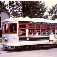
Long-established neighborhoods to the east and west of College were largely built up, and major new construction had to wait until basic housing shortages were answered first. The neighborhoods included some basic business services, principally small grocery stores and automobile service stations. Residents could walk to a grocer's nearby or drive only a short distance to have an automobile serviced and fueled. Along Mountain and Whedbee citizens also had the option of taking the trolley. The East Side and West Side neighborhoods still represented a community where pedestrian travel was feasible even if auto trips might be preferable. In an approximate fashion Vine, Shields, Laurel, College, Prospect, and Riverside formed the town boundaries.
There were signs of growth and new economic thinking, however, particularly in the vicinity of the intersection of Mulberry and Shields and near East Prospect and College. The first represented expansion toward the foothills, while the second was a harbinger of the explosive growth in decades ahead toward the south and east, a movement that would obliterate farmlands in the area. A shrewd thinker at the time might have surmised correctly that the expansion of the town would be toward the south and east, for the foothills to the west and the river and industrial areas to the north would hamper new subdivisions in those areas. On the other hand, no one could have foreseen the construction of the interstate highway several miles to the east of downtown and how it would influence growth.
The new thinking in housing and family living was exemplified by the homes on Circle Drive, occasional ranch-style houses elsewhere, and a trend toward attached garages. By the standards of the 21 st century these homes were modest in style and pretensions, but in the 1940s they were a break from the multi-story dwellings that were indicative of domestic high style architecture in the decades before World War II. Single-story or split-level homes would be the wave of the future.
Reviewing the city as a whole, including commercial, industrial, and residential areas, the evidence suggests that the building stock from the prewar period stayed in place in the late 1940s, as did the distribution among the three types of areas. In addition to the details on each neighborhood, it is also possible to fold in information in regard to annexations and additions, schools, churches, demolitions, arterial street addresses, and agricultural lands. Collectively they are persuasive in indicating that the town was not yet in a stage of rapid growth. Fort Collins, then, was on the cusp of change, but that change would begin to make itself felt in the 1950s rather than in the immediate postwar.
Baume, Lawrence I. Historic Survey of Downtown Fort Collins: Laporte to Olive Streets on College Avenue. Fort Collins: City of Fort Collins and the Department of History, Colorado State University, 1983.
Beier, Harold. Fort Collins History and General Character. Fort Collins: City of Fort Collins Community Development Consultant, 1958.
City of Fort Collins Advance Planning Department. City of Fort Collins Annexation Trends. [map]. 2006.
City of Fort Collins Planning Department. City Park Neighborhood, Architecture and Building Survey. Fort Collins: City of Fort Collins Planning Department-Advance Planning, 1986.
Community Services Collaborative. Architecture and History of Laurel School Neighborhood. Fort Collins: City of Fort Collins Planning and Development Department, 1983.
Community Services Collaborative. BAVA Neighborhood Architecture and Buildings Survey: Buckingham, AltaVista, Andersonville. Fort Collins: City of Fort Collins Planning and Development Department, 1983.
Community Services Collaborative. Architecture and History of Holy Family Neighborhood. Fort Collins: City of Fort Collins Planning and Development Department, 1983.
Coronado, Ramon. "Neighborhoods Tell Hispanic History." The Coloradoan. September 27, 1981 page 6.
East Side Neighborhood Steering Committee. East Side Neighborhood Plan. Fort Collins: City of Fort Collins, 1986.
Fort Collins Local History Archive.
Harris, Cindy, and Adam Thomas. "Fort Collins E-X-P-A-N-D-S:" The City's Postwar Development, 1945-1969. Fort Collins: City of Fort Collins Advance Planning Department, November 2010 draft.
Historic Old Town Planning Committee. Old Town Fort Collins, Colorado Area Plan. Fort Collins: 1980.
Historic Resources Preservation Program Plan, an Element of the Comprehensive Plan. "Appendix A: A Partial List of Demolished Structures, Fort Collins, Colorado." City of Fort Collins, 1994.
"Landmark Passes on." The Coloradoan. June 8, 1983, page A6.
Marmor, Jason. A Cultural Resources Inventory of the Old Fort Site, Fort Collins, Colorado. Fort Collins: City of Fort Collins Advance Planning Department, 2002.
Marmor, Jason. An Inventory of Historic Properties in and around the Central Business District of Fort Collins, Larimer County, Colorado. Fort Collins: City of Fort Collins, Advance Planning Department, 1996.
McWilliams, Carl, and Karen McWilliams. Agriculture in the Fort Collins Urban Growth Area, 1862-1994. Fort Collins: City of Fort Collins Planning Department, 1995.
Polk's Fort Collins City Directory, 1938. Salt Lake City: R. L. Polk & Co., 1938.
Polk's Fort Collins City Directory, 1948. Omaha: R. L. Polk & Co., 1948.
Schoeman, Christian J. Survey of Historic Structures Located within the Fort Collins Downtown Development Area, Conducted during an Internship with the Planning Department of the City of Fort Collins from May 17 to August 30, 1983. Fort Collins: Planning Department of the City of Fort Collins, 1983.
Simmons, R. Laurie. Survey of Historic Buildings in Fort Collins, Colorado, 1992: Final Survey Report. Fort Collins: City of Fort Collins Planning Department, 1992.
Southwest Neighborhood: Architecture and Buildings Survey. Fort Collins: Fort Collins Planning Department, 1987.
Swanson, Evadene. Fort Collins Yesterdays. Ft. Collins: Don-Art Printers, Inc., 1993
Thomas, Adam. Hang Your Wagon to a Star: Hispanics in Fort Collins, 1900-2000 (State Historical Fund Project 01-02-065). Fort Collins: City of Fort Collins Advance Planning Department, 2003.
Thomas, Adam. In the Hallowed Halls of Learning: the History and Architecture of Poudre School District R-1. Fort Collins: City of Fort Collins Advance Planning Department, 2004.
Thomas, Adam. Soldiers of the Sword, Soldiers of the Ploughshare: Quonset Huts in the Fort Collins Urban Growth Area. Fort Collins: City of Fort Collins Advance Planning Department, 2003.
Thomas, Adam. Work Renders Life Sweet: Germans from Russia in Fort Collins, 1900-2000 (State Historical Fund Project 01-02-065). Fort Collins: City of Fort Collins Advance Planning Department, 2003.
Thomas, Adam, and Timothy Smith. The Sugar Factory Neighborhoods: Buckingham, Andersonville, Alta Vista (State Historical Fund Project 01-02-065). Ft. Collins: City of Fort Collins Advance Planning Department, 2003.
Tresner, Charlene. Streets of Fort Collins: a History of Fort Collins, Colorado, through Its Street Names. revised edition. Fort Collins: Patterson House Book Publishing, 1994.
Tunner, Carol. An Overview of the Fort Collins Park System Emphasizing City Park As It Relates to the Development of the Community. Master's Thesis. Fort Collins: Colorado State University, 1996.
Tunner, Carol. North College Avenue: Historical Research for the North College Avenue Study. Ft. Collins: City of Fort Collins Historic Preservation Office, 1993.
U.S. Bureau of the Census. Census of Population: 1950; Volume II, Characteristics of the Population, Part 6, Colorado. Washington D.C.: Government Printing Office, 1952.


Preserving the history of Fort Collins, Colorado & the Cache la Poudre region